This project has received funding from the European Union Framework Program for Research and Innovation (SC5-18a-2014) under grant agreement nº 641538
Management_________________________________________
 CREAF is in charge of the management of the project, with the support of the Project Management Board, the Project Technical Board and the Project Advisory Board. The procedures for project management and quality assurance within the project are detailed in the Consortium Agreement, which was signed by the project beneficiaries and establishes the Work Package Management, the Communications and Reporting and the development of the Project Meetings.
Structure____________________________________________
-
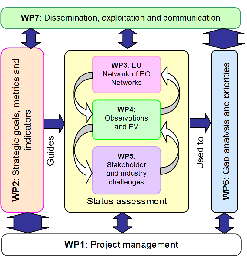
Provide efficient and effective management of the project, management of the WPs and coordination between participants, efficient exchange of information with the project team and a communication channel for the EC.
-
Define the strategic goals (based on GEOSS Strategic Targets, SDGs, and planetary boundaries) that the project will use as a reference. Establish indicators to measure progress towards these goals. Define the essential variables (EVs) required to quantify these indicators. Define how the EV can be extracted from observations.
-
Establish a European Network of Earth Observation Networks that can provide opinions and evidence of gaps in observation networks. Engage with this Network on various fronts. Collect and synthesize this information from the Community Portal (WP7). Generate a report on ways to complement remote observations with in-situ observations.
-
Monitoring the current observations contributing to GEOSS through the GCI and the DAB. This is pursued by the GEO DAB (Discovery and Access Brokering) framework creating and populating in a systematic way an inventory of the brokered bservations. Analysing the created inventory as a systematic approach to recognize the different observed properties and their types (e.g. low level observations, high level bservations, essential variables, indicators, etc) and the existing gaps. This is pursued, by leveraging the information and knowledge contained by the URR2.0.
-
The supporting actions and networking activities in these projects must be tested and improved as soon as possible to ensure viability in real world scenarios. Therefore this work package contains two challenges to identify gaps in the procedures and methods, and to demonstrate business opportunities.
-
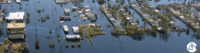
Determine the gaps in observation networks in Europe using both a top down and a bottom up approach. Define priorities to cover those gaps.
-
Secure a lasting impact of the project ensuring that the activities and results of ConnectinGEO are well understood by the community. Ensure the reuse, exploitation and sustainability of the ConnectinGEO activities and results beyond the project. Constant communication and generation of communication materials.
Work Plan___________________________________________
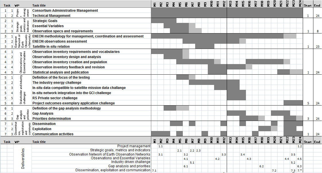
Overview
Objectives
Participants
CREAF
Tiwah
CNR
IIASA
CMCC
52º North GmbH
S[&]t Corporation
ICM
BIRA
ARMINES
NILU
EXETER
Institut Mines-Télécom
IEEE
EARSC